
ABOUT:
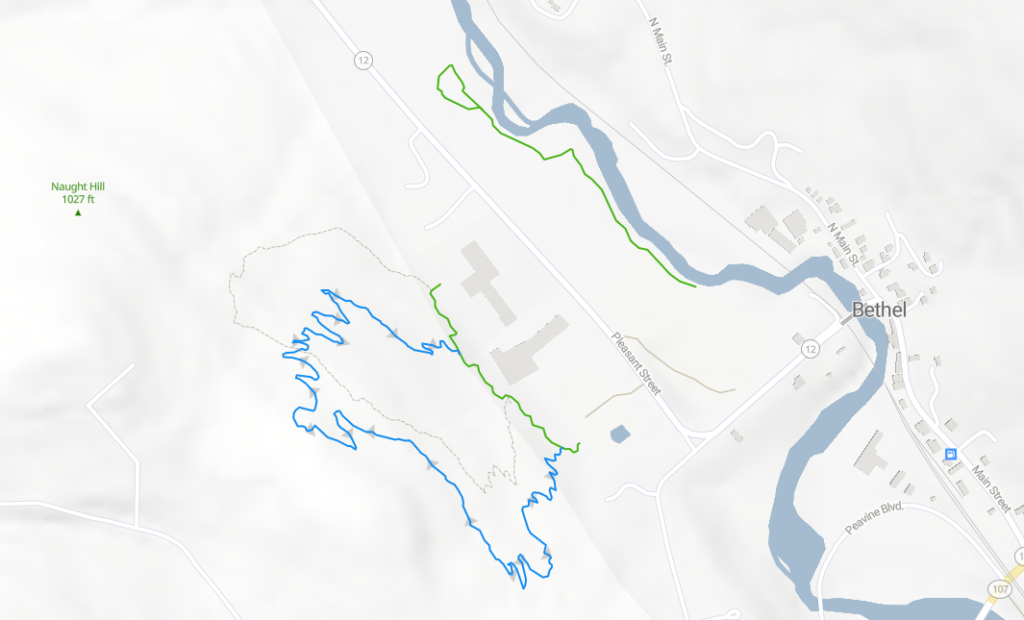
The Bethel Trail System is currently made up of two intersecting hillside trails and a connector trail behind and between the Bethel School Campus and the Bethel Recreation Area on the west side of Pleasant St (VT Route 12). There is also a riverside lollipop loop trail along the Third Branch of the White River, beginning at the Bethel Athletic Fields on the east side of Pleasant Street.
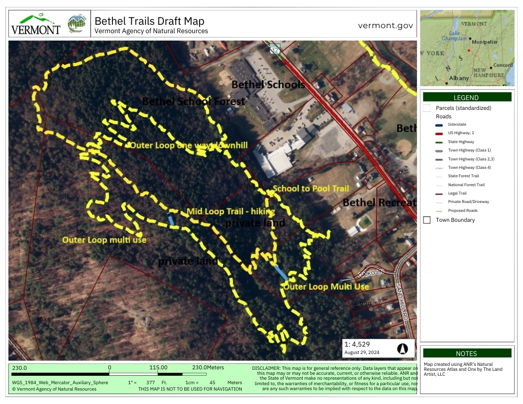
The hillside trails on the west side of Pleasant St are currently known as the School to Pool Trail (.5 miles), the Outer Loop Trail (2 miles) and the Mid Loop Trail (1 mile). Trail users and students will be tasked with coming up with new, more creative trail names in the coming months.
The School to Pool Trail is a short connector trail between the Bethel Recreation Area and the Bethel School Campus that passes through town, private and school forest lands. The approximately one half mile trail is built to multi use standards and is suitable for hiking, running, mountain biking and snowshoeing.
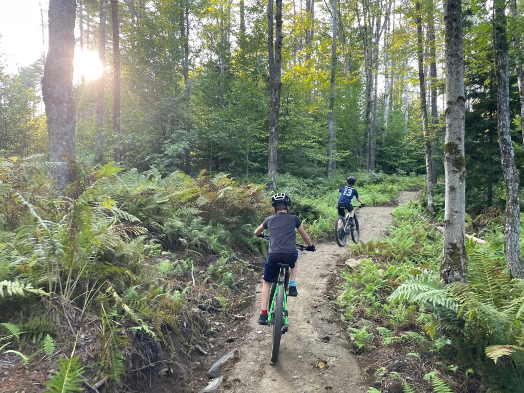
The Outer Loop Trail is a 2 mile long multi use trail designed for hiking, mountain biking, running and snowshoeing, that is best accessed from the parking lot of the Bethel Recreation Area. Users follow the School to Pool Trail for a short distance into the woods behind the recreation area where the Outer Loop begins at a well marked interestion. The trail starts with a strenuous, switch backed climb up to a gravel town water service road. Just before the service road there is a signed short connection trail to the Mid Loop Trail. The Outer Loop crosses the service road and then begins a moderate switch backed climb up the next slope before passing through an area of softwood forest and back into the hardwoods at the high point of the trail. There is a second, short, signed connector trail to the Mid Loop trail along this section of the Outer Loop. From the high point of the Outer Loop the trail switches back through hardwood forest to a direct intersection with the Mid Loop Trail. At this point the Outer Loop is recommended for downhill travel only as the trail switches back and forth through another steep section of softwood forest, ending at the School to Pool Trail behind the Bethel School Campus. The Outer Loop passes through town, private and school forest lands.
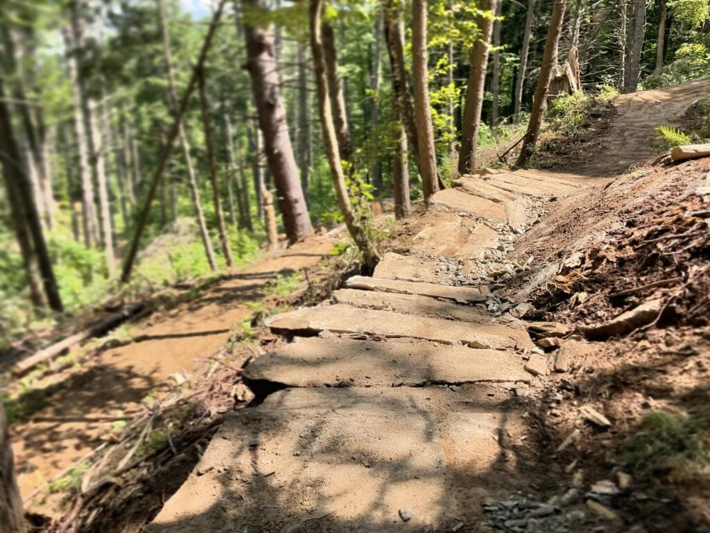
The 1 mile long Mid Loop Trail is geared primarily for hiking, running and snowshoeing, but has several sections suitable for mountain biking that can be utilized in conjunction with the School to Pool Trail and Outer Loop Trail to create a variety of different and interesting loop rides, hikes or runs. The Mid Loop begins at a marked intersection with the School to Pool Trail, about 100 yards after the beginning of the Outer Loop as you travel from the Bethel Recreation Area. The Mid Loop starts with a moderate climb through a mixed forest to a new section of switchbacked trail with a short stone staircase. At the bottom of this new section is where the first connection to the Outer Loop intersects. After a steep climb through the new switch backed section, the Mid Loop joins the gravel water tank service road for a short distance before re-entering the softwood forest and continuing below and parallel to the Outer Loop to the point where the second connection with the Outer Loop joins the trail. The Mid Loop then continues along a flat ridge to the point where the Mid and Outer Loops directly intersect and the downhill, one way travel section of the Outer Loop begins. The Mid Loop continues past the Outer Loop before turning downhill along an old woods road and then onto a newer section of hiking trail on the school forest. The Mid Loop joins another section of old woods road and drops down to the area where the Outdoor Classrooms are located in the school forest behind the main campus. The Mid Loop ends at the School to Pool Trail near the main trail access bridge behind the developed portion of the campus. The Mid Loop Trail passes through town, private and school lands.
Parking and access to all of the west side trails is best at the Bethel Recreation Area.
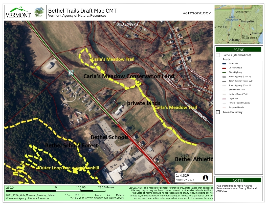
The current trail on the east side of Pleasant Street is the 1 mile long Carla’s Meadow Loop Trail. This trail begins at the end of the Athletic Fields access road that dead ends at the river. The trail currently passes over mowed grass, passing by ballfields as it heads north. After leaving school property the trail is marked across mowed grass next to the river across four parcels of private land before entering town conservation land known as Carla’s Meadow. The trail on town lands has been resurfaced with natural materials. There is a short loop to the right toward the river and a short spur trail with a view of the river. The main trail turns to the west along the hedgerow and follows the field edge of the area of stabilization plantings, before turning back toward the river and making a loop back to the main trail. This trail has little or no slope and is suitable for hiking, running, mountain biking, snowshoeing or cross country skiing. This is also a great trail for wildlife viewing along the river and associated wetlands.
Best parking and access for the Carla’s Meadow Trail is the Athletic Fields parking lot. Foot travelers can also park at the Bethel Bandshell Park and access the trail by taking the pathway next to the brick church and going down the staircase to the athletic fields.
Future plans are to construct a 3,000’ pathway built to accessibility standards around the athletic fields in 2025 and to eventually connect the trail systems on each side of Pleasant Street.